Augusta's Premier Aerial Survey, Photography, and Videography Services
Precision Aerial Insight for Georgia
Augusta Helicopter Charters offers comprehensive aerial survey capabilities across Georgia, utilizing the inherent low-altitude flight and precision hover characteristics of helicopters. This facilitates critical data acquisition for projects such as magnetometer and electromagnetic surveys, LiDAR mapping, and advanced GIS integration. Furthermore, our specialized aerial filming services provide access to sophisticated cinematography and photography platforms, including options for door-off operations to accommodate specific handheld camera requirements. We are dedicated to equipping professionals with tailored aerial solutions designed for optimal data fidelity and visual content capture, supporting diverse industrial and commercial objectives across the region, from the Oconee National Forest to the Golden Isles.
Aerial
Surveys
LiDAR, GIS Maps, FLIR, HD Video & More
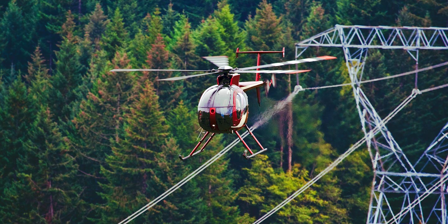
Augusta Helicopter Charters provides essential aerial support for critical infrastructure management, encompassing pipeline surveys, Right-of-Way (ROW) inspections, and transmission line patrols. We ensure access to the precise aircraft and specialized equipment necessary to execute your vital infrastructure projects with accuracy and adherence to operational standards, maintaining asset integrity across Georgia.
High Tech Results
The Top Pilots in Georgia, Today's Technology... Maximum Results.
Call 1-866-826-4826 Now!
Augusta Helicopter Charters provides the tools needed to complete your land surveys, utilizing the right equipment to provide the aerial photos that are often needed.
Effective aerial surveys streamline critical operations such as Right-of-Way (ROW) and site inspections, precise topographical data acquisition, and high-definition imagery capture for commercial development projects. Helicopters provide an unparalleled platform for comprehensive assessments of Georgia's diverse terrain, enabling detailed pipeline integrity checks, proactive detection of transmission line anomalies, and thorough property documentation. Augusta Helicopter Charters excels in developing bespoke photographic and remote sensing operations, meticulously customized to maximize both technical precision and financial efficiency, ensuring superior data yields for your strategic initiatives across the state, from the Savannah River to the Appalachian foothills.
Helicopters offer distinct advantages for aerial surveying, attributed to their superior low-altitude flight capabilities and precise loitering control compared to fixed-wing aircraft. While FAA regulations mandate a minimum of 1,000 feet above obstacles for fixed-wing operations, helicopters can conduct missions at significantly lower altitudes, facilitating more granular data collection. This operational versatility also permits close-proximity inspection of challenging or hazardous zones, providing engineers and project managers with critical, otherwise inaccessible, vantage points for comprehensive assessment and informed decision-making across Augusta and surrounding regions.
There is no better way to conduct your visual survey, animal population counts, soil drainage analysis, ROW inspections, pipeline and transmission line inspections, and geographical surveys.
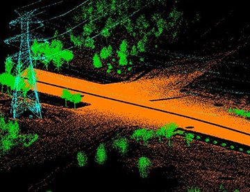
LiDAR Imaging
Light Detection and Ranging, or LiDAR, is a remote sensing method used to examine and measure Georgia topography as well as objects, like vegetation, upon it.

Infrared Imaging
Thermographic IR cameras are used to detect radiation in the long-infrared range of the electromagnetic spectrum and produce images of that radiation, called thermograms.
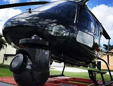
HD Video Gimbal Capture
Modern HD and 4K cameras can be mounted to helicopters, using the proper STCs, with a gimbal to stabilize photos & videos for detailed results.
Advanced Aerial Cinematography for Professional Productions
For expert camera work in the Augusta Sky
Get a Fast, free QuoteAugusta Aerial Cinematography
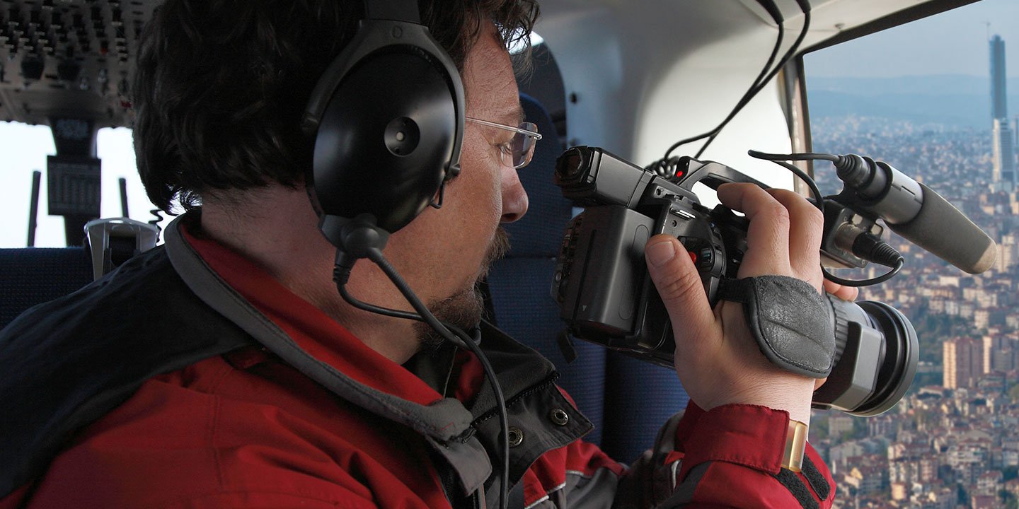
Augusta Helicopter Charters provides comprehensive access to advanced aerial cinematography solutions throughout Georgia, enabling professional-grade visual content creation. We facilitate custom aerial productions by integrating cutting-edge technology, including industry-standard gyro-stabilized camera mounts such as Tyler Mounts, Wescam, Cineflex, Pictorvision, and SpaceCam. These platforms support a variety of specialty cameras, including Cineflex HD, RED Epic, Arri Alexa, alongside 3D and experimental camera systems. Our services expertly accommodate diverse production requirements, from dynamic air-to-air sequences to intricate ground-to-air compositions, ensuring all technical and creative objectives are met. Specializing in support for both still and motion photography, Augusta Helicopter Charters is equipped to facilitate a broad spectrum of media operations across Georgia. This includes film and television productions, documentary projects, promotional videos, commercials, aerial prop deployment, critical relief work for broadcast networks, and extensive coverage of historical and major sporting events, all provisioned with the optimal rotary-wing aircraft to suit the specific demands of your project in areas ranging from Augusta's urban landscape to the expansive rural counties.
Call Us Today at 1-866-826-4826 for a Free Quote
Contact Us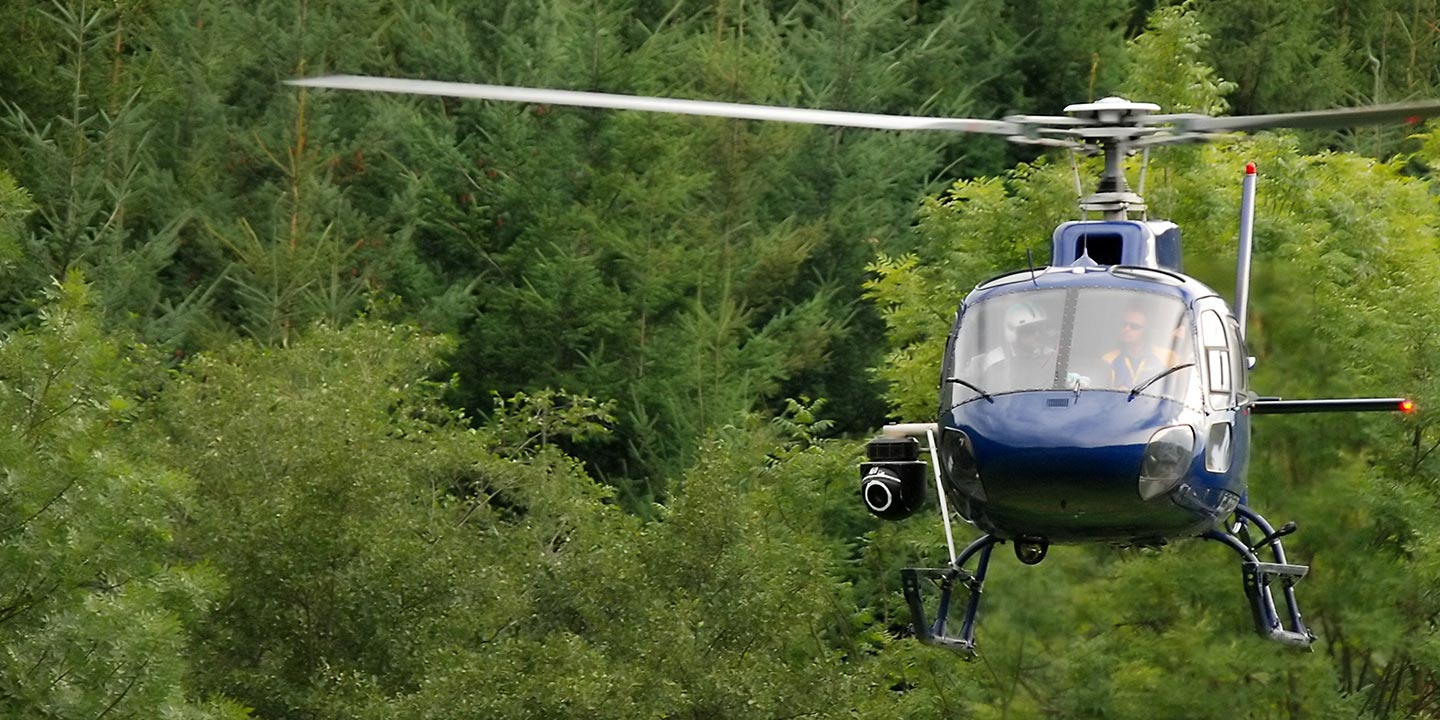
Aerial Photos
Hand-held or Mounted OpTions in Augusta
We will help you get the right equipment for your aerial photography project! Call 1-866-826-4826 today to get a fast, free quote.
The Most Options for Photography
Leveraging Georgia's diverse landscapes for high-impact visual content requires specialized aerial platforms for optimal capture. Augusta Helicopter Charters provides access to precision aerial photography charters engineered to meet stringent technical specifications and artistic visions. We facilitate the acquisition of superior imagery through cost-effective solutions, offering versatile aircraft configurations. Many helicopters can be configured for door-off operations, allowing for greater flexibility with handheld camera systems. For applications demanding enhanced stability and cinematic quality, information regarding advanced gyro-stabilized camera mounts is available upon request, ensuring the precise execution of your photographic and videographic projects across the state, from the Savannah River shoreline to the mountains of North Georgia.
Superior Service
Every one of our customers gets a dedicated helicopter expert to assist with flight plans, tech loadouts, production logistics, project schedules, and other demands.
Over 500 Aircraft
Our network of direct air partners extends well beyond Augusta, Georgia. This allows us to offer a wide range of solutions for even the most sophisticated projects.
The Best Equipment
From high-tech sensors like LiDAR, FLIR, and GIS to HD cameras and movie production gimbals, we're here to make your job as easy as possible.